Brautarlækur is a small cottage situated on a 1.7-hectare plot of land within the estate of Krókur, in the upper reaches of Norðurárdalur in Borgarfjörður. I first became acquainted with the place in the autumn of 1986, when my wife dragged me there to help gather sheep for Alla at Hreimstaðir. As the years have passed, the bonds have grown stronger. Bit by bit, I’ve come to know the nature of the land better, as well as its history through my father-in-law’s countless stories of the struggle for survival in the last century.
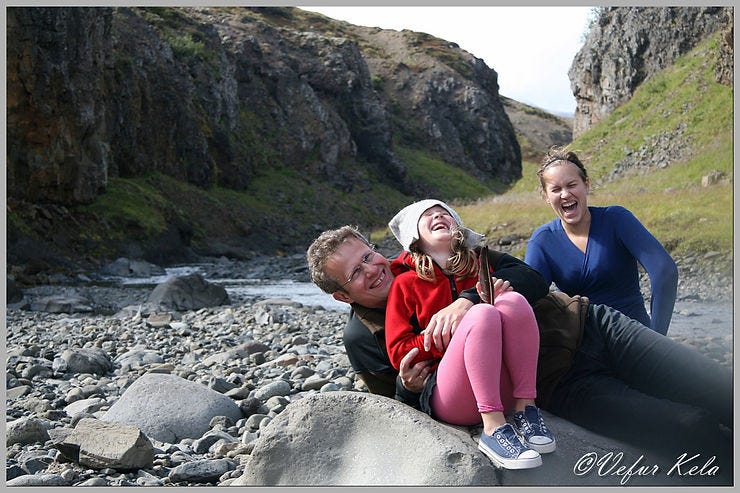
This is where my wife’s roots lie. She grew up mostly at Krókur until her parents ceased farming. Here lies the life’s work of her parents, her grandparents, and the valley likely holds the history of even more distant ancestors. My two daughters have found immense joy in the moments our family has spent there, far from the bustle of city life. Personally, I feel that as the work of my own hands increases there, my connection to the place strengthens. Perhaps because it makes one feel like a part of the history of the place—and that the place has become a part of oneself.
This account isn’t just about life in the valley, but about the place names that define our horizon from the northwest to the north. It’s a point of pride to know the land; one wouldn’t want to be like the famous ‘Lási the Cook’ who, when asked about Mt. Esja, could only say that the mountains ‘had been there for quite a while.’
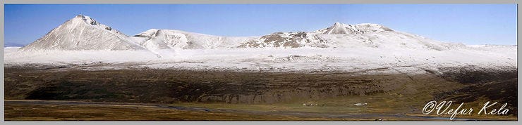
Looking northwest, the most prominent feature is Baula, a cone-shaped rhyolite mountain rising 936.6 meters. In 1993, my wife Guðrún and I climbed it in beautiful weather. I remember it like walking up endless stairs, as the mountain is incredibly rocky. Though we were drenched in sweat, the reward at the summit was a breathtaking panoramic view. While the best route is said to be from the ‘shoulder’ between Mælifell and Baula, we took a steeper path further west, where loose scree slid beneath our feet with every step. Interestingly, the first recorded ascent wasn’t until 1851 by Halldór Bjarnason. Likely, people in earlier centuries saw no reason to scale such peaks unless absolutely necessary.
North of Baula stands Mælifell (777 m), one of twelve mountains in Iceland with that name. Its name likely stems from being a ‘measure’ or landmark for travelers on the old thoroughfare toward the Dalir region or the Westfjords. That trail ran alongside the mountain through Bjarnadalur, on the far side of what is visible here. Beyond Mælifell lies Baulusandur, Litla Baula (839 m), and Skildingafell.
The river winding through the valley is the renowned Norðurá. South of it lies the farm Háreksstaðir and a rocky mound by the river called Beinhóll (Bone Hill), which was long a prime spot for salmon fishing. To the north, you can see the end of Hvammsmúli, where it meets a gorge carved by the Litlaá river. Near there is a stream bed where an old path called Langa gata (Long Path) once led up to Fellaflói, a marshland where men used to harvest hay. The effort people expended for a bit of fodder is truly staggering. Even the valley framed by the peaks is called Sátudalur (Haystack Valley)—perhaps a hint that farmers traveled even that far for hay. It is also the source of the Dýrastaðaá river.
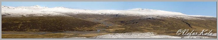
In the center of the view above is Sanddalur, with the Sanddalsá river flowing through it. Deep within the valley, Mjóidalur branches off. If one follows Mjóidalur to its end, you arrive at Illagil (Evil Gorge). Beyond the gorge, high in the mountains, lie the Grafartindar peaks. It is likely these peaks that are visible directly above Hvammsmúli, which borders the western side of the valley. Directly above the head of the valley is Sandur, and looking northeast from there, the 1,001-meter-high Tröllakirkja (Trolls’ Church) comes into view. South of Tröllakirkja lie the Snjófjöll (Snow Mountains).
Legend says that around the time of the Settlement, trolls would gather at Tröllakirkja to hold council, distressed by the ever-increasing intrusion of human settlers. Things reached a breaking point when Icelanders converted to Christianity. When the first church was built at Stað in Hrútafjörður, a giantess living near Tröllakirkja decided to take matters into her own hands. She hurled a massive boulder at the church during its very first mass. Her aim was off; the rock landed in a horse paddock, killing four horses. Realizing her time in the valley was over, she packed her belongings and moved north to the Strandir region, seeking more solitude. No reports of trolls have been heard near Tröllakirkja ever since.
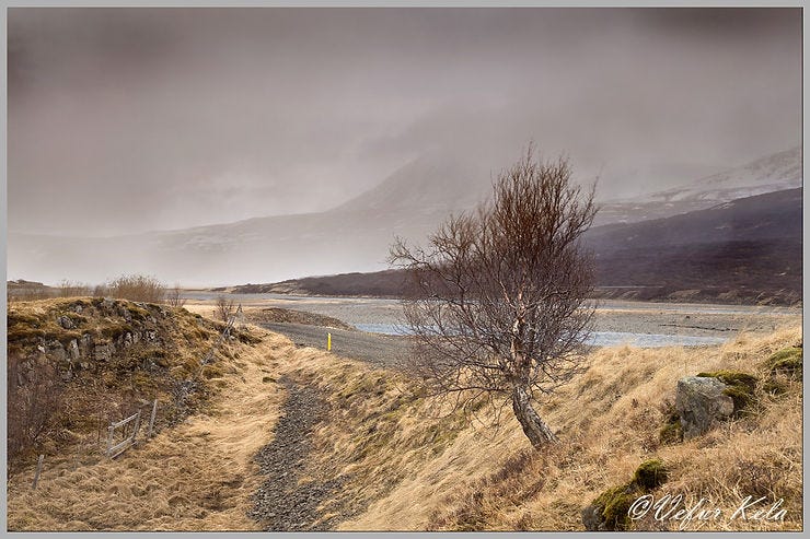
The upper valley did not seem very hospitable to me when I first arrived. The piercing north wind cuts to the bone as it comes charging down Sanddalur. It’s no wonder that verses were once composed about the harshness of life in this part of the valley.
Norðurárdalur is quite chilly at its northern end.
No maidens thrive there; they are all but hags and crones.
Today, farming has ceased at the uppermost farms in Norðurárdalur. This was certainly not the case around the turn of the 1700s, when the 'Farm Verses' were composed, documenting a bustling community in every corner of the valley.
In Hvammur dwell noble folk with holy faith.
To Galtarhöfði I now make my way; there, the hay yield is meager.
Deep in the valley, men behold Sanddalstunga.
At Geststaðir, the brave ones sang; a joyful folk in Sveinatunga.
Mörkrók alone and Háreksstaðir can here be found.
At Hóll, Halldór does his labor; Margrét is his wedded wife.
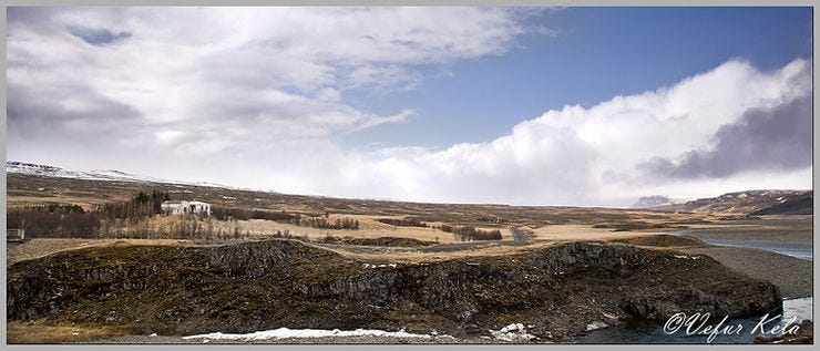
To the west of Sanddalur and Hvammsmúli lies the church-land of Hvammur, and to the east of the valley and Sveinatungumúli sits the settlement farm Sveinatunga. The farm at Hvammur was moved to its current location after a devastating avalanche in 1808, which claimed the life of the priest’s son. In Sveinatunga stands the oldest stone farmhouse in any Icelandic rural district. No farm buildings remain within Sanddalur itself, though it once held three: Galtarhöfði west of the Sanddalsá river, Geststaðir to the east, and Sanddalstunga at the valley’s head. Today, a few summer cottages dot the valley.
South of the Norðurá river are the farms Krókur, Háreksstaðir, and Hóll. Farming has ceased at Krókur and Háreksstaðir, though it continues at Hóll. Near Krókur, one can still discern the ruins of Blesastaðir, the home of the settler Þorbjörn ‘blesi’. Legends say his son, Gísli, had a farm at Háumelar, and Lake Gíslavatn bears his name.
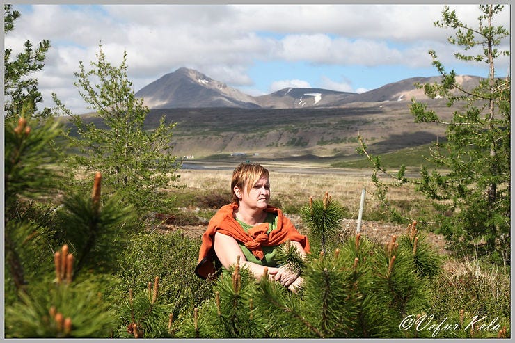
When I first came to Brautarlækur 28 years ago, I wanted to try planting some trees. I had little faith in the endeavor, as there was nothing to suggest that trees could survive there; the only vegetation higher than the grass were a few knee-high willow shrubs along the brook. I shared this wish with my father-in-law, and while he readily granted me permission, he offered little hope for fast or steady growth. He knew from experience how difficult this land is to cultivate. However, he had a story to tell.
Sheltered from the north wind behind the farmhouse at Krókur stood a few handsome spruce trees, and by the roadside, just across the bridge over Norðurá, stood a solitary birch shrub. The trees behind the house hadn’t always been there; they were rescued when the road south of the river was constructed. My parents-in-law had originally planted them on a rocky outcrop overlooking the river, just below the farm. When the road was built, the Road Administration insisted on excavating fill material from right beneath the trees. Some were saved and moved behind the farmhouse, while others found a new home at the Hraunsnef farm further down the valley. The birch shrub by the roadside is the only one that survived the construction in its original spot.
The old man, therefore, had firsthand experience with planting in the upper valley and knew it could succeed. He also pointed out the birch growth on Hvammsmúli. He maintained that the slopes south of the Norðurá had once been as forested as those on the north side. His theory was that because the church lands often held wood-cutting rights on other estates, they could spare the forests on their own land. For instance, Reykholt Church had rights to gather wood in Sanddalur, which is known to have been forested. He also urged me to look into the deep gully carved by Brautarlækur itself. Deep within the banks, one can find substantial ancient tree trunks preserved in the earth. Thus, there was every reason to give forestry a try.
It is a joy to share that the current owner of Krókur has been actively planting trees in recent years—tens of thousands of them. The results become more visible with every passing summer. The owners of Sveinatunga have also pursued forestry with clear success. At our little cottage by Brautarlækur, the trees have grown steadily, and they have finally begun to provide shelter from the cold north wind. Who knows? Perhaps in my old age, I will be surrounded by a forest here at the foot of Holtavörðuheiði.
The north wind isn’t always biting in the upper Norðurárdalur. Often, the weather is sublime, as described here:
By Brautarlækur, on a bright night,
not a blade of grass stirs in the wind.
Silently flows the brook, all is at peace,
here is your life and your delight.