
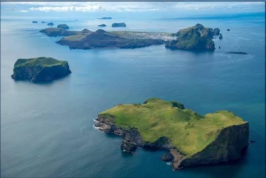
The Westman Islands are a cluster of 15 to 18 islands rising from the sea south of the mainland, stretching toward the southwest. Furthest south is Surtsey, which is the second largest after Heimaey. Surtsey was formed during a volcanic eruption between 1963 and 1969. Heimaey is the only one of the islands whcin is inhabited. The earliest accounts of the Westman Islands tell of the slaying of Hjörleifur’s slaves. The islands were named Vestmannaeyjar (Westman Islands) in reference to this event and the origin of the slaves. They were said to be from Ireland and Scotland, and people from those regions were called “Westmen” at the time. Herjólfur Bárðarson was said to be the first to settle the islands in the tenth century, but archaeological research has shown remnants of settlement on Heimaey prior to that, dating back to the ninth century before the settlement of Ingólfur.
The islands were formed by volcanic eruptions over the last 50,000 to 70,000 years. The oldest part is about 40,000 years old, but they have likely accumulated mostly over the last 15,000 years. Helgafell was formed in an eruption about 5,000 years ago, and next to it stands Eldfell, which erupted in 1973. That event is fresh in the memory of my wife and me, despite us being only six and seven years old at the time. Even though we were so young, it was our parents’ reaction when they heard the morning news on the radio the morning the eruption began. From their reaction, it was immediately clear to us that something serious had happened. We also know numerous stories from the Islands, both new and old. Naturally, we wanted to see the site of these events with our own eyes. Therefore, visiting Heimaey has been on our agenda for a long time.
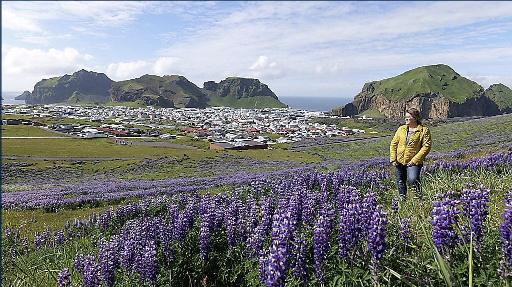
We decided, as soon as it was open to apply for summer rentals in the holiday homes of the Icelandic Teachers’ Union (KÍ), to try our luck and apply for an apartment in the Islands. KÍ owns two new apartments there, and we got one of them. Around two o’clock on Monday, June 29, we arrived in Heimaey. The weather was excellent, so our first task was to walk up Eldfell to enjoy the view over the island while the sun was shining. Eldfell was formed in 1973 when an eruption began around two o’clock after midnight. The walk up the mountain is an easy stroll, as the mountain is only 200 meters high. From the top, there is a good view of the town, the harbor entrance, and the oldest part of the islands, which are the Northern Cliffs (Norðurklettar). The Northern Cliffs consist of Heimaklettur, Miðklettur, Ystiklettur, Dalfjall, Klifið, and Blátindur. These are the oldest parts of Heimaey. Up on the mountain, we met a Norwegian family who had clearly just arrived in Iceland, as the mother asked me if there were more beautiful places like this in Iceland. I replied that there certainly were.
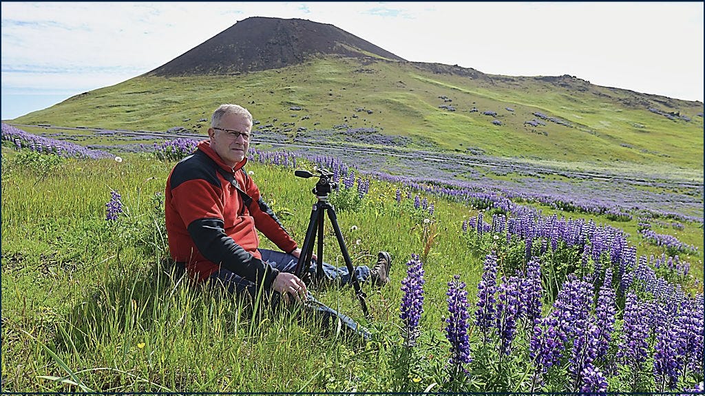
Later that day, we met this fine family again by the water trough from which Guðlaugur Friðþórsson drank during his walk back to civilization after the boat Hellisey sank on March 11, 1984, approximately five and a half kilometers from land. The boat’s fishing gear got caught on the seabed and capsized the vessel. Two young fishermen perished immediately, but three managed to get onto the ship’s keel. They sat there for about an hour or until the boat sank. Three of them started swimming. Soon, Guðlaugur was swimming alone. It took him about five hours to swim to land. He reached the shore south of Helgafell. Then followed a three-hour walk, part of which was over rough lava fields. It was 6:55 AM when he made his presence known, but Hellisey had capsized at eleven o’clock the previous night. The fact that Guðlaugur survived is purely incomprehensible. I told the Norwegians this story, and the father of the family asked after the story session, “Did this actually happen?” The same thing happened later in the trip when a guide on a boat tour around Heimaey told the same story. People seem unable to believe that anyone could survive such an ordeal.
After saying goodbye to the Norwegians, we went out to Stórhöfði. Stórhöfði is the southernmost part of Heimaey. There has been a lighthouse there since 1906 and a weather station since 1921. We have heard many news reports of severe storms there, and above all, Stórhöfði is best known for its poor weather conditions. It is, in fact, one of the windiest places on Earth, excluding Antarctica. It holds various weather records. Nowhere on land in Europe has atmospheric pressure been measured lower, at 919.7 hPa, and nowhere in Europe is the average wind speed higher. Calm weather on Stórhöfði is rare, occurring only about four times a year. Incredible but true, there was a tiny breeze when we were there, very close to total calm.
Stórhöfði is connected to Heimaey by a narrow isthmus called Aur. On the west side of Aur are Víkin and Klaufin. The beach has often been called Costa del Klauf by locals. As the name suggests, this is the place in Heimaey to sunbathe on the beach on the rare occasions when the weather permits. The name is a reference to a well-known beach that sun- and beach-deprived Icelanders frequently visited in Spain. On the eastern side of the isthmus, the beach is called Brimurð. There, below Litlahöfða, is Ræningjatangi (Pirate Point). The point got this name after pirates from Algeria took advantage of the opportunity to land there on July 16, 1627. In total, the pirates numbered 300 and arrived on three ships. They set up camp at Ræningjaflöt in Lyngfellsdalur. They rampaged through the island for three whole days. They hunted down and captured people, burned houses and people, killed those who resisted, as well as the elderly and infirm. When it was all over, the pirates had killed 34 people and abducted 242. The abducted people were taken to Algiers and sold into slavery.
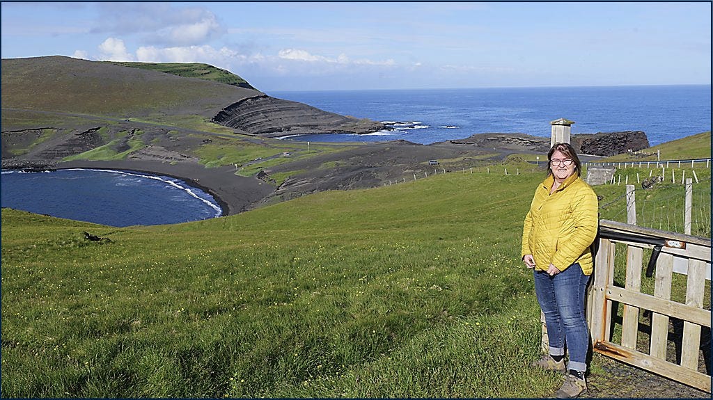
In 2005, a puffin viewing birdhouse was built in Stórhöfði. From the house, there is a good view of the puffin colony in Stórhöfði, and it is large. It is estimated that around 700,000 birds nest in the cape. The puffin begins arriving at the cape in April. It digs half-meter-deep burrows where it lays its single egg. The chick stays in the burrow for 45 days. When it leaves the burrow, it heads out to sea. It spends 3 to 5 years out on the open ocean fishing before it returns. The lights of the town sometimes confuse the chicks because they are drawn to the lights. That is when the puffin chick season (pysjutíminn) begins for the kids in the Westman Islands. They gather the chicks and guide them the right way to the sea. The adult bird leaves the cape in August and spends the next seven months deep south and southwest of the country.
From the birdhouse, we walked to the southernmost part of Stórhöfði, where there is a good view of the southern islands. Like Heimaey and the northern islands, they are located on a volcanic belt that is approximately 35 km long and 20–30 km wide. Numerous eruptions have occurred on this volcanic belt, but most of them have been so small that no islands or skerries were formed. Occasionally, however, it has happened. The oldest southern islands—Álsey, Brandey, Suðurey, and Hellisey—were formed eight thousand years ago. Surtsey is the youngest island, formed in the 1960s. Two of the islands are named after birds. Súlnasker hosts the second-largest gannet colony in Iceland after Eldey. Centuries ago, Geirfuglasker was one of the three havens for the Great Auk in Iceland. The Great Auk had disappeared from the skerry around 1800 due to overhunting. In the immediate vicinity of Súlnasker is Geldungur. The name of the skerry likely refers to the fact that birds rule there completely. The islanders have used the islands for sheep grazing, but due to a lack of vegetation, the island of Geldungur does not offer that option. Before the 1896 South Iceland earthquake, Geldungur was a single island, but today it forms two islands: Stóri-Geldungur and Litli-Geldungur. They were connected by a magnificent stone arch that collapsed in the earthquake.
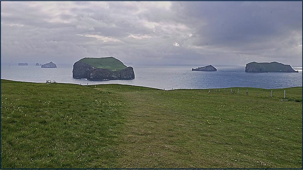
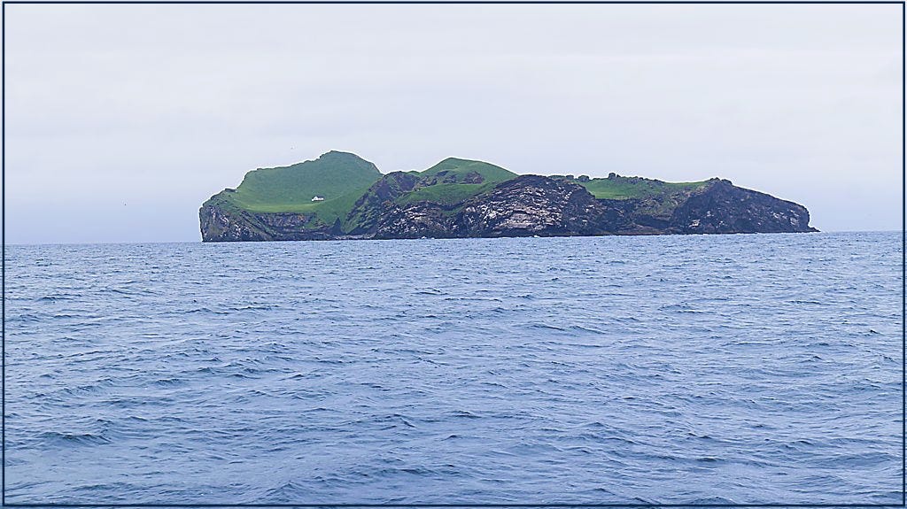
We felt we couldn’t miss taking a boat cruise along the coast. During the cruise, the guide talked about local life in the islands, nature, and how the islanders have utilized it for their livelihood. In several of the outer islands, there are hunting cabins owned and maintained by the islands’ hunting associations. The houses are used as bases when members of the hunting associations are gathering eggs or hunting puffins. Those islands that are grassy enough have been used for sheep grazing, and the houses have then been used as a center for the people involved in transporting the sheep out to the islands and during the autumn gathering. Moving the sheep and herding them is a difficult task and by no means without danger, as the islands are incredibly steep. Pictures of this sheep handling in 2021 can be seen here.
The tourism industry has begun to yield a great deal, with 15–20% of revenue coming from that sector. The third and fourth pillars are, of course, dependent on the other two. On one hand, other services, retail, and the construction industry generate 15–20% of the income. The share of public services is then around 10–15%. During our boat tour around Heimaey, we saw massive construction projects in the new lava field. There, the company Laxey is building a land-based fish farm. That production could well become a valuable addition to the economy in the Westman Islands. Plans estimate that the fish farm will support 5–8% of the jobs in the Islands, and revenues could reach up to 50 billion ISK per year, which would account for 25–30% of the total value creation in the Westman Islands. It would certainly be wonderful if this comes to fruition.
Recent events in Grindavík certainly remind us that we live on a volcanic island, and that can have consequences. The Westman Islands serve as an example that a community can rise from the ashes, even if nature knocks it down for a while. Before the eruption, there were 1,350 houses in the Westman Islands. About a third of them fell prey to the lava, or 417 houses. Therefore, many people lost their homes. Before the eruption, 5,303 residents were registered in the Westman Islands, but currently, 4,639 people live there. Visiting Eldheimar was fascinating. It is a museum that tells the story of the eruption, the rescue of the people, and the destruction. Although we knew this history well, exploring this exhibition was highly interesting. One can only imagine how powerful the emotions must be when watching your home turn to nothing, completely helpless to stop it. The exhibition at Eldheimar captures this beautifully, and the centerpiece of the exhibit is the house that stood at Gerðisbraut 10. It was excavated, and the museum building was constructed around it. It was also interesting to see the house Blátindur at the edge of the lava, where the only thing remaining is a small extension that was on the house. The Eldheimar museum is well-designed and just the right size. We certainly recommend it.


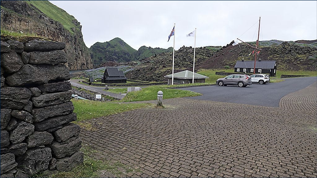
Skansinn in the Westman Islands has a long history. It is located by the harbor entrance, directly opposite Heimaklettur. The name of the place refers to the first fortifications built in this area. The Danish word skans means a fort, and in 1586, a fort was built by order of the Danish king near Kornhóll. The purpose of the fort was to protect Danish merchants from the encroachment of the English, as it is well known that locals were strictly forbidden from trading with anyone other than Danish merchants. The name Skansinn is actually a shortening of the proper name of the place, which is Kornhólsskans. Today at Skansinn, there is a stave church that the Norwegians gifted to the inhabitants of the Westman Islands, which is a replica of the first church built in the Islands after the adoption of Christianity in the year 1000. Also located there is the house Landlyst, which is notable for being the first maternity home in Iceland. Previously, the house stood in the town center. The landscape there is both beautiful and dramatic. In the past, when boats lacked radios, the loved ones of sailors would sometimes go out to Skansinn during perilous weather. One can only imagine the immense relief when people saw the boats appear by Klettsnef and sail in under the cliffs toward the harbor.
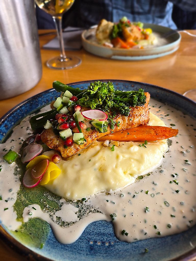
Our daughter is somewhat familiar with the Westman Islands and recommended that if we were going out to dinner—and since Slippurinn had already closed—the restaurant Gott would be a great choice. So, we booked a table there and were not disappointed. The catfish was excellent. Right next door to Gott restaurant is the Brothers Brewery. A delightful pub with a large selection of craft beers, and the apartment we stayed in was in the house just next to that. Distances are short in this small town center.
The church history of the Westman Islanders is as long as Christianity in Iceland itself. Shortly before the adoption of Christianity, the first church in Iceland was built in the Islands using timber that Gissur the White and Hjalti Skeggjason brought to the country. The first Landakirkja church was built in 1573 in the area where the current church stands. That church was burned during the Turkish Raids in 1627, but another was built four years later where the graveyard gate stands today. The current church was built between 1774 and 1780. The bells in the church date from 1617 and 1743. The church was locked when we arrived, so we could not view it from the inside. Our next sight in the Westman Islands was Kúlan (The Sphere). Kúlan is an artwork that the municipality of Westman Islands purchased from the artist Ólafur Elíasson for tens of millions of ISK. We thought the piece was tasteful enough to look at, but one wonders whether the 220–250 million ISK spent on the artwork might have been better spent on something else?


Barren, soot-black, newly formed lava is not attractive. Over time, however, vegetation settles into the lava, and the view that was once harsh and forbidding becomes appealing and beautiful. To speed up this process, the municipality of Westman Islands organized a project where residents and community associations were offered the chance to adopt designated plots in the new lava. No signs of this project remain today, except for Gaujulundur. Gaujulundur is the work of the married couple Guðfinna Ólafsdóttir and Erlendur Stefánsson. The grove is like an oasis in the desert and stands as a testament to what diligence and perseverance can achieve. However, it is often the case that human creations fade when the founders lose the strength to maintain the work. Today, the grove is very beautiful and well worth visiting. This is thanks to a Latvian woman named Renate Heisele, who took it upon herself to give the grove a new life.
Inside Herjólfsdalur is the only proper freshwater spring on Heimaey. Therefore, it was a given that Herjólfur Bárðarson chose the valley for the first homestead built on Heimaey. In 1874, Icelanders celebrated one thousand years of settlement in Iceland, and that is when the people of the Westman Islands held the first National Festival (Þjóðhátíð) in Herjólfsdalur. At first, it was held every now and then, but annually since 1901. In the valley, there is a reconstructed turf house with a small settlement exhibition that tells the story of Herjólfur’s family and his companions. This was the last thing we did during our stay in the Westman Islands.


The weather was beautiful and sunny the day we arrived in Heimaey and then again on the day of our departure. We decided to drive the countryside road through Landeyjar rather than cruising straight up to the main highway, as the weather invited a sightseeing detour. We didn’t have a map, so we just drove as long as there was a road. In the distance, we saw a church and initially thought we had arrived at the church at Oddi in Rangárvellir. That turned out not to be the case, as it was Akureyjarkirkja. We sat down inside the gate and had our packed lunch in the company of those resting in the churchyard. This church was built in 1910. It is located almost right next to the community center Njálsbúð. We drove further and missed a turn we should have taken, ending up on some fishing trail. We turned around and shortly after arrived at the church at the historic site of Oddi in Rangárvellir. It is believed that there has been a church at Oddi since the beginning of Christianity in Iceland. The church currently there was built in 1924 and seats one hundred people. Now, there are ideas to elevate the status of the site and build a more grand church to replace the old one. That church would serve as a house of worship, a concert hall, and a cultural center.

